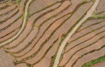
CHANGCHUN, May 23 (Xinhua) -- A Chinese science academy has come up with an independently-developed camera for capturing three dimensional (3D) photographs for geographic mapping.
The research was done by scientists of the Changchun Institute of Optics, Fine Mechanics and Physics, affiliated to the Chinese Academy of Sciences.
Ding Yalin, the chief scientist of the project, said the resolution of the camera developed by the team can reach 0.08 meters when taking photos from the height of 2,000 meters, which is almost twice as high as that of the most advanced products of the same kind abroad.
The camera has wide application potential for geographic mapping, general surveying of agriculture and forestry, natural resource exploration and island mapping, Ding said.
The team has achieved a number of scientific breakthroughs in the development of optical lenses, which include large aspheric surface design and processing and high-precision flexible lens adjusting technology.
It has developed a software system for automatic processing of data captured by the camera.
Ding said the camera's application has been tested in a number of surveying and mapping projects under a variety of geographic conditions. The photos are evaluated to have a high resolution and mapping accuracy.
The team is working on the commercialization of the camera.


